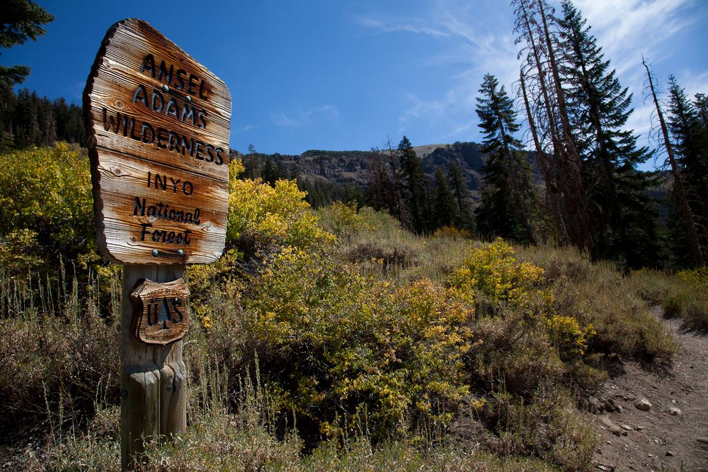
With the backpacking season drawing to a close, my buddy Dale and I decided to squeeze in one last trip. The Ansel Adams Wilderness had name appeal but looking at a few pictures from the area, it was an easy decision. We wanted to do a short, three day trip to appease the women we're leaving at home so we picked a 24 mile semi-loop that would end at the Devil's Postpile National Monument.
We arrived the night before and camped near the Agnew Meadows trailhead, which is where out excursion would begin. Unfortunately, the next morning we had to backtrack to get the wilderness permit. 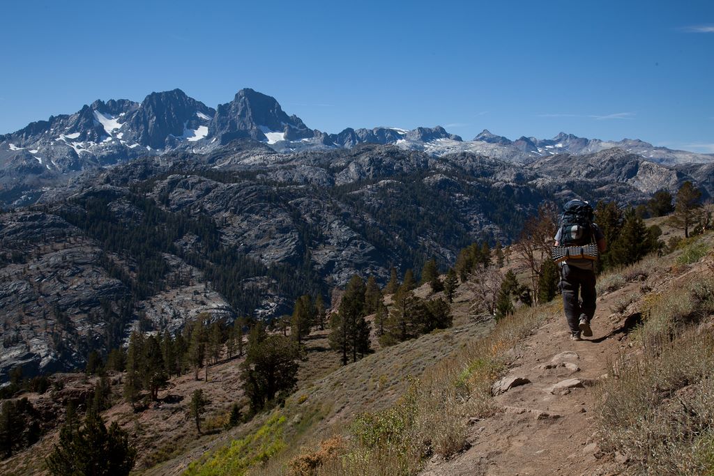 Once the paperwork was squared away and we obtained our bear canister, we made our way back to Agnew Meadows, hopped on the High Trail around 11am and immediately started heading up. After some light forest, we found ourselves hiking along a nice grassy slope overlooking the Minarets and Shadow Lake. We hiked along the slope for several miles with Shadow Lake shimmering across the valley. After six miles, the trail drops back down into the forest and meets up with river trail. From there, it was a short hike to Thousand Island Lake. As we approached the lake, we first encountered smaller alpine lakes, crystal blue and ice cold with the Ritter Range as the backdrop. After making our way up one last hill, we found ourselves at the foot of a huge lake. The land surrounding Thousand Island Lake is fairly flat and doesn't allow you to fully appreciate its size. And since we
 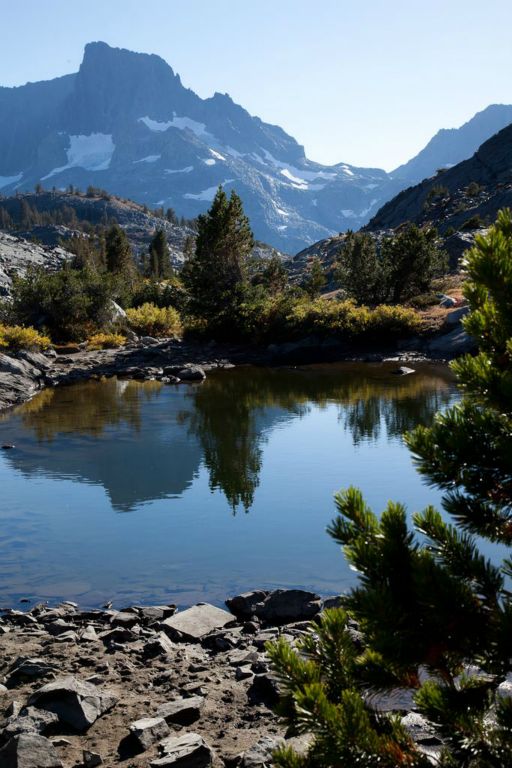 weren't staying at the lake, I took the opportunity to hike along the northern edge to take in the scenery and snap a few pics.
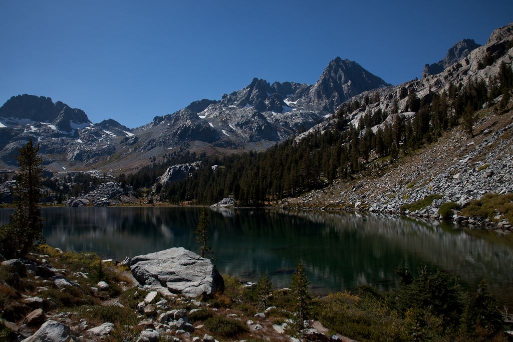
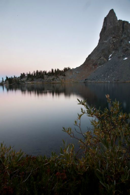
With daylight fading, we took the trail towards Garnet Lake, which meant that we were now on the John Muir Trail. Once arriving at the lake, there were only a few spots suitable for camping but luckily there were no other campers around. We did a little scouting and the best spot was littered with large rocks, so we rolled them out of the way, threw up the tent and started on dinner. We later realized that the rocks were there because the campsite was in a wash zone, which means that if rain started to fall, we would risk being swept into the lake. Since the forecast called for clear skies for our entire trip, we decided to leave the tent where it was. And while we didn't expect any rain, we did expect freezing temperatures. So once the sun had set, we quickly bundled up, downed a hot dinner and jumped in the tent. After seven hours of hiking and 11 miles behind us, we were ready for a good night's rest.
 The next morning, I stayed in my sleeping bag until the sun was shining on the tent. When I finally slithered out, I was greeted with amazing views of the lake. The night before, everything had a very gray tint to it, but now everything was bright green and blue, with Ritter range casting spectacular reflections. I downed some granola for breakfast and spent some time wandering around the rocky area surrounding the lake. After fully taking it in, we packed up our tent and started towards our next campsite at Minaret Lake.
Leaving the campsite, the trail passes across a bridge before winding around the lake and up and over a small pass. Unfortunately, we took the wrong path after crossing the bridge 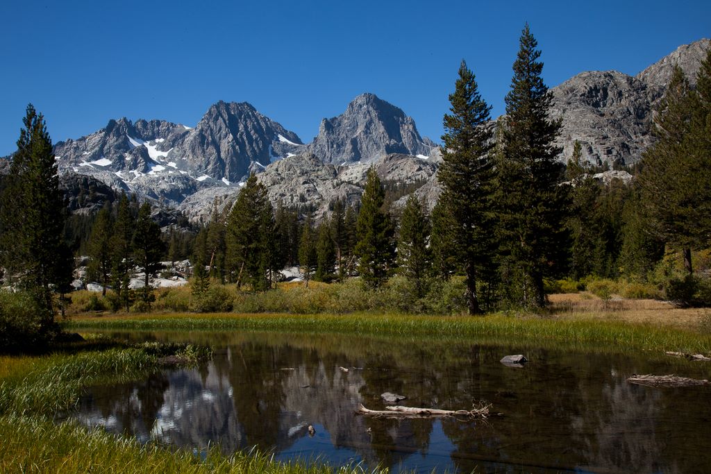 and burned some energy climbing down a steep rocky trail before hiking back up it. At least the correct trail offered much better views of Garnet Lake so we quickly forgot about our wasted effort. After a short hike, we made it over a small pass and into a talus field. Not much fun, but we would encounter much worse later on. The trail sheds a little elevation and eventually we found ourselves standing high atop a valley that looked like a bowl surrounded by towering mountains. Looking at the map, it seemed we would be hiking into the valley and then straight up into the mountains. It looked daunting, especially since this was supposed to be an easy day. Once again, our ability to read elevation on a map failed us.
 Once we were down in the canyon, we found a great stream to relax by. While there, we heard some shouting coming from somewhere in the mountains. Not a distress call, but more of people just being loud. We heard it a few more times (which we weren't happy about) before a group of CCC (Civilian Conservation Corps) came strolling down one of the trails. First, it was a group of five. Then five more. Another ten. In all, about 30 of them descended out of the mountains. Most of the guys were sporting full beards so Dale wagered they had been there for a while and were happy to be leaving. It was unusual to see so many people at once, especially since we only saw five people the previous day and a handful on this day.
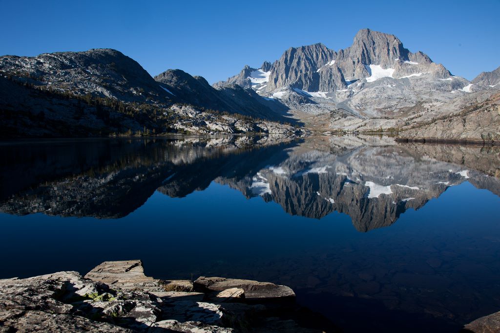
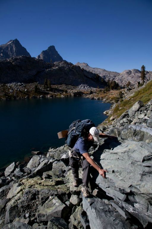 After relaxing and checking out the waterfalls in the area, we started our hike up to Ediza Lake. The hike wasn't too difficult (or at least not nearly as hard as we were expecting) and once there, we were rewarded with a great view of what I think is the prettiest lake on the trip. It was also the most crowded of all the lakes. I just wished it was a little warmer so I could have jumped in. But that wasn't in the cards, so we followed the trail up to Iceberg Lake... which is where things started to get interesting. Iceberg Lake itself isn't anything spectacular, but it's surrounded by a 45 degree slope of loose rock fragments. The talus feels like it wants to break your ankles at any time. And Dale was wearing tennis shoes since he had not yet replaced his hiking boots, so I kept waiting for him to injure himself. Luckily, it never happened. We did however see several other people on the talus, none of which seemed to be enjoying it. The only thing that would be less fun would have been doing it earlier in season when it was covered with snow.
We followed the loose resemblance of a trail and made it out of the Iceberg Lake bowl. Our reward was Cecile Lake and 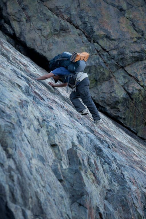 the boulder field that surrounded it. This was another challenge, but also made for an interesting element to the trip. And we're all about the adventure. After hopping the boulders and getting away from the lake, the only thing left for the day is to descend down to Minaret Lake and set up camp. Sounded easy enough but we knew from our guide book that we would have a ten foot down climb. We were actually looking forward to it. So when the trail appeared to abruptly end, we were standing on top of large slanted slab of granite with a crack that would allow for an easy way to descend. So descend we did. After the talus and boulder fields, we were getting pretty good at picking out the routes. So we scouted the area for the easiest way down. There was what appeared to be a dried creek bed that was more or less vertical. Maybe this is what we were supposed to down climb. So I hopped down and started making my way down. At one point, it required me to use some hand holds to safely make it down to the next flat area. I looked a little further down and realized that no way in hell were we still on the trail. After a short discussion with Dale, we decided to keep going. We were ready for some adrenaline.
 So we pushed on and kept looking over the edge and the bottom never seemed any closer. It still looked like we had 200 feet to go. 200 vertical feet. We cautiously continued since there several spots while descending that we couldn't see if there would be any where to put our feet, but we lowered ourselves over the edge knowing something would just be there. As we neared the bottom, we encountered a particular tricky spot. Dale was able to scoot down on his butt to get to a secure place to swing around and down climb about 10 feet, but my pack extended too far down to easily do the same maneuver. Dale threw up his rope and I lowered my pack down to him. Well, more like I started to lower the pack before I realized there was too much slack, at which point my pack slid over the edge and towards Dale's head before I was able to yank back on the rope to stop the pack just inches above his head. I scared the hell out of Dale but luckily we avoided an injury.
We eventually made it down to the ground with adrenaline coursing through our veins. It was probably the craziest thing we had done to date. I wish there were more pictures, but I decided it was best to stash the camera in my pack instead of it danging around my neck. As we approached the campsite area, we didn't 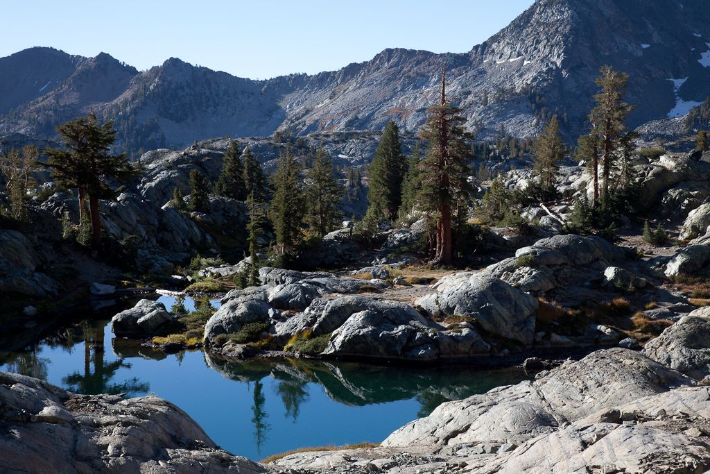 have to do much scouting since the entire way down we could see pristine camp sites along the lake. Nobody was in sight so we had our pick of where to set up. We couldn't get dinner cooked and eaten fast enough as all we wanted to do was lay down and relax. That night, we ended up playing cards for a couple of hours and I soundly beat Dale repeatedly.
In the morning, we were eager to get going and get down to Devil's Postpile. At this point in the year, the shuttle bus wasn't running so we had to try and find a nice stranger that would give two smelly guys a ride back to our car. So by 8 am, we were departing Minaret Lake. Just on the other end of the lake was a stunning picturesque stream that we followed all 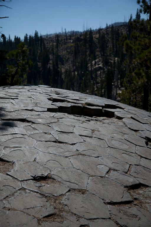 the way down. There were several cascades and waterfalls that we would stop and rest by. The trail eventually leveled out, which meant we were close to Devil's Postpile. Once at the national monument, we checked out the hexagonal shaped basalt formations before making our way to the car, courtesy of a guy in a Range Rover.
All in all, this was an amazing three day trip. This was the most variety in terrain and surroundings that we had encountered. The alpine lakes were abundant and spectacular. Solitude was better around the campsites as there were quite a few day hikers out and about. And while there was minimal wildlife and the scenery wasn't as grand as other parts of the Sierras, it was definitely a trip worth taking. Especially if you're looking for an adventure.


