 After spending more time in California,
the bar has definitely been raised on what a park should offer.
It has to include some difficult sections (read, vertical) and
several miles of scenic hiking. While there are some great
options out in west Texas, the options are fewer near Austin.
That said, Lost Maples is one of my favorite parks in Texas.
It has natural beauty with crystal clear spring fed ponds,
waterfalls, caves, and vertical elevation that allows you to see the
ponds from high above.
After spending more time in California,
the bar has definitely been raised on what a park should offer.
It has to include some difficult sections (read, vertical) and
several miles of scenic hiking. While there are some great
options out in west Texas, the options are fewer near Austin.
That said, Lost Maples is one of my favorite parks in Texas.
It has natural beauty with crystal clear spring fed ponds,
waterfalls, caves, and vertical elevation that allows you to see the
ponds from high above.
This trip, we talked my buddy Thomas into coming along. The
trip offered him an excuse to dust off some of his old gear and hit the
trails with us. So that's us, heading out on Friday towards
Lost Maples. In typical fashion, we got going later than
expected (had to stop by Cabella's and buy overpriced items) but
made it to the park around 3pm. Once in the park, we parked in
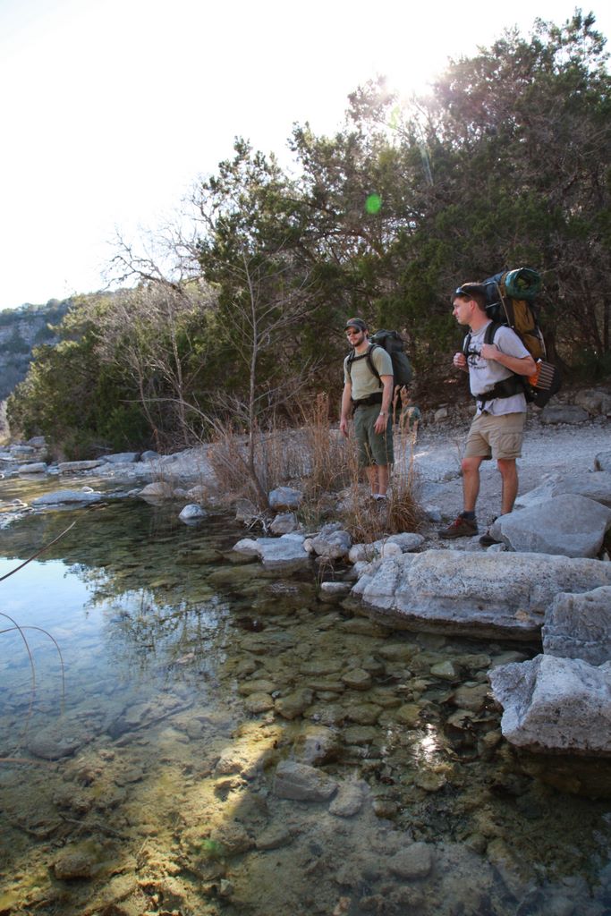
the east parking lot and started our two mile trek to Campsite A via
the Maple/East Trail. Along the way, we enjoyed the crystal
clear water with miniature waterfalls dotting the stream. The
water level was low but still flowing. It was still winterish,
so there were lots of gloomy looking trees and brown. Clearly
this is not the most scenic time to visit the park.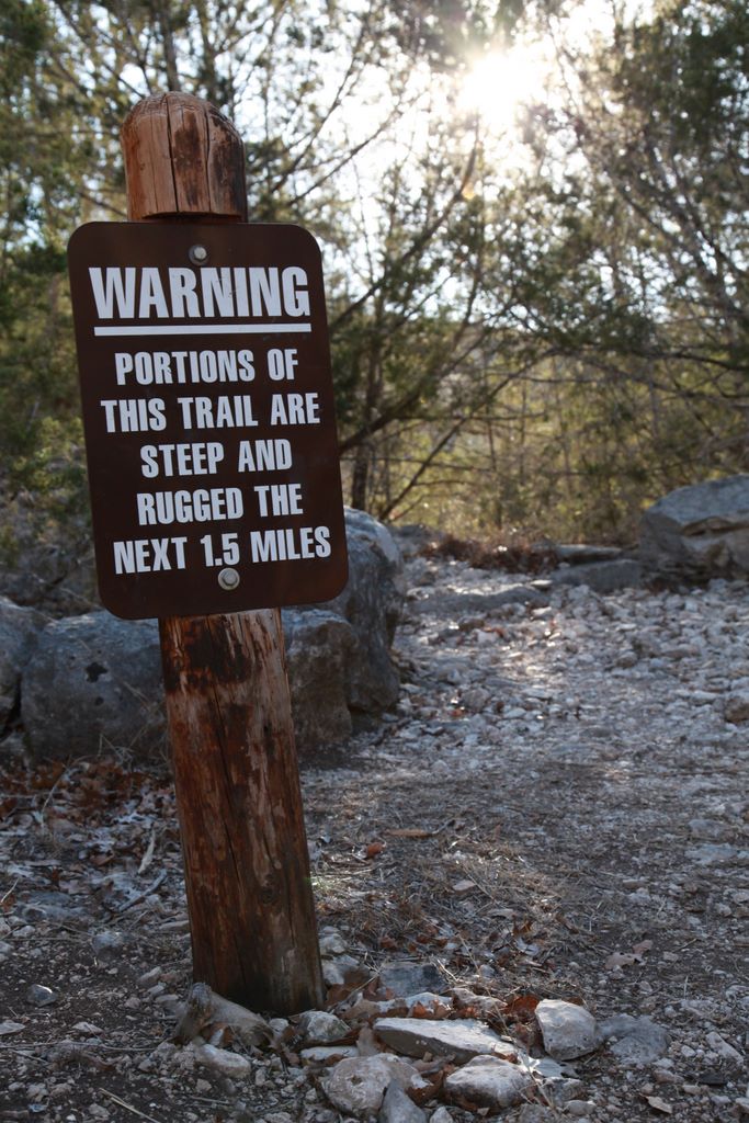
Once we arrived at Campsite A (where we camped on the previous trip), we dropped our gear, Dale went to relieve himself when he nearly pissed on some guy's just out-of-site campsite. Oops! After a quick discussion, we decided there was enough time to keep going and find an isolated site. So our new target was Campsite B, which posed some problems of it's own. Since B is dry and the nearest water was 400 feet below it, we either needed to hike in water now, or set up camp and make an extra trip for the water. We went with the second option.
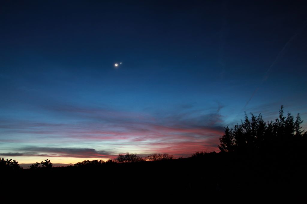
The hike between sites A and B represents some of the tougher terrain the park has to offer (as indicated by the sign), but I would still say it was a moderate hike. As you ascend, you do get some nice views along the way. Once at the top, it is a fairly uneventful hike to the split for B with the exception of the scenic outlook. From this vantage point, you can see the ponds, Campsite C and the hill country. We would be back later to watch the sunset and smoke a cigar.
As we headed to B to find a spot and set up camp, we came across a
longhorn grazing. I think he was lost but didn't seem too
concerned. Just to play it safe though, we camped a bit away
from him. After getting everything set up, we were
surprised to see another group of kids come through also looking to
camp at B. We figured the lack of water would keep people away
but that was a bad
 assumption. They filed past us heading
towards the longhorn. We figured it would work itself and
decided it was time to get some water. We descended along the
trail, enjoying not having a backpack for a change, to the pond.
Once there, we sat along the banks and enjoyed the evening for a
while. Then it was time to haul the water back to camp and get
some grub.
assumption. They filed past us heading
towards the longhorn. We figured it would work itself and
decided it was time to get some water. We descended along the
trail, enjoying not having a backpack for a change, to the pond.
Once there, we sat along the banks and enjoyed the evening for a
while. Then it was time to haul the water back to camp and get
some grub.
What we didn't realize when we were setting up camp is that we were doing so in a wind turbine. A couple of hours after we crashed, the wind picked up quite a bit. At some points, the tent was literally folding over the top of my face. It made it interesting but difficult to sleep. I tried to shrug it off and keep sleeping.
 In the morning, the temperatures had dropped quite a bit so we added
some additional layers. We packed up and hiked down to the
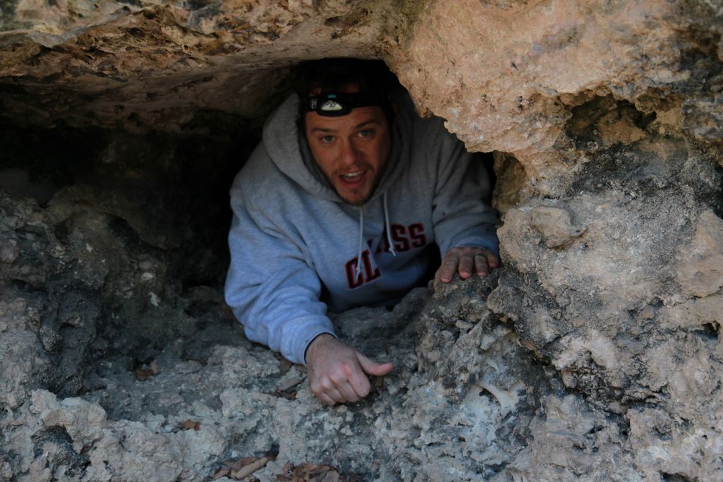
pond. The previous day, we spotted some caves so now that we
had better lighting, we decided to do some spelunking. It was
surprisingly difficult to find the caves. Once we got up on
the side of the hill, we couldn't spot them anymore. Thomas
actually had to walk back down to the bottom to do some spotting for
us. With his help though, we finally found what we were
looking for. There was a string of small caves with the
largest being about 8x8x4. Others gave you enough room to
squeeze just yourself into. A bit spooky, but fun.
In the morning, the temperatures had dropped quite a bit so we added
some additional layers. We packed up and hiked down to the
pond. The previous day, we spotted some caves so now that we
had better lighting, we decided to do some spelunking. It was
surprisingly difficult to find the caves. Once we got up on
the side of the hill, we couldn't spot them anymore. Thomas
actually had to walk back down to the bottom to do some spotting for
us. With his help though, we finally found what we were
looking for. There was a string of small caves with the
largest being about 8x8x4. Others gave you enough room to
squeeze just yourself into. A bit spooky, but fun.
Once done with the caves, we continued along the West trail towards
the spring. When we were here the previous
 summer, it was nice
and hot and the spring was perfect for cooling off. This go
round, there would be no getting in the spring. Namely because
it was cold, but also because once we arrived at the spring, it was
not much more than a trickle. Oh well, we still decided to
relax in the area and enjoy some snacks. After our break, we
continued along the West trail with more of the same scenery as the
rest of the park, just with less water. We complete the hike
in a couple of hours and we were off headed home.
summer, it was nice
and hot and the spring was perfect for cooling off. This go
round, there would be no getting in the spring. Namely because
it was cold, but also because once we arrived at the spring, it was
not much more than a trickle. Oh well, we still decided to
relax in the area and enjoy some snacks. After our break, we
continued along the West trail with more of the same scenery as the
rest of the park, just with less water. We complete the hike
in a couple of hours and we were off headed home.


